
- Drones – Compliance with Regulations: Provides population density data for SORA assessments, ensuring compliance with European regulations and improving accuracy in risk assessments.
- Drones – Optimizing Flight Routes: Helps drone operators select safer routes by identifying high-risk zones and optimal flight times.
- Data-Driven Marketing: Enables marketing teams to target populated areas effectively, maximizing campaign impact and conversion rates.
- Effective Emergency Responses: Supports authorities in assessing emergency severity and allocating resources based on population density.
- Urban Planning: Assisting city planners in making informed decisions about infrastructure development and resource allocation based on population density.
- Event Management: Estimating crowd sizes for events to ensure adequate security, facilities, and services.
Population Density Data
API Description
The “Population Density Data” API provides population density estimations for a specified area and time interval.
With this API, developers can retrieve population density data per km², offering insights at different time intervals based on three key values: (1) Minimum population, (2) Average population, and (3) Maximum population.
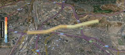
These estimations are derived from anonymized historical data of network-connected devices in the requested area, ensuring accuracy while maintaining privacy.
Use Cases
Benefits
- Regulatory Compliance: Facilitates adherence to European drone regulations with dynamic population data, ensuring accurate risk assessments and smoother approval processes for flight authorizations.
- Safety Optimization: Drone operators can optimize flight routes by considering number of people and time, while also also assess whether ground risk is acceptable for the time of the flight, or an alternative time should be considered to lower the risk.
- Higher Marketing Efficiency: Enhances campaign effectiveness by targeting high-density areas, allowing marketing companies to optimize resource allocation and improve outreach impact.
- Improved Crisis Management: Facilitates faster and more informed emergency responses, enhancing efficiency and mitigating the impact of disasters.
- Operational efficiency for the API customer (cost savings).
API Portfolio: Location Services
SubProject Wiki: N/a, Independent Sandbox, See API Wiki
(incl. how to meet the team)
API Wiki: Population Density Data
API Repository: Population Density Data
API Repository Status: Sandbox
API Status: Initial
API Version(s) and Release Date(s):
- v0.1.0 (20.06.2024), initial version
- v0.1.1 (11.09.2024), Fall24 meta-release
- v0.2.0 (14.03.2025), Spring25 meta-release
- v0.3.0 (10.09.2025), Fall25 meta-release
API availability: Information which APIs are available in which country and network, and how to get access can be found on the GSMA public launch status page.